VR-Planning - we're planning with Augmented and Virtual Reality!
In the research project "VR-Planning - we're planning" the use of Virtual Reality (VR) and Augmented Reality (AR) for an improved support of participative planning of public (transport) spaces is investigated and the findings are compiled in a guideline.
The planning of future-oriented and sustainable road spaces always requires the exploration of different interests of different user groups. The application of participatory methods for the planning of public transport spaces is already standard here and also prescribed in regulations. The design of traffic areas in particular, which increasingly prioritize active mobility and push back motorized private transport, is particularly fraught with conflict. It is often difficult to mediate between the widely divergent concerns and needs of different users, and even minor changes in road space lead to long coordination phases, which increase many times over in large infrastructure projects.
The goal of the project "VR-Planning" was to create a common understanding for an inclusive and sustainable road design more efficiently through the use of VR and AR. Through the targeted use of VR and AR, innovative road designs can be experienced realistically and the cooperation of planners, politicians and the participation of citizens can be improved. This promotes mutual understanding and increases the acceptance of new road designs. The project considered four possible forms of participation in planning processes: Information, consultation, cooperation and interaction between planners.
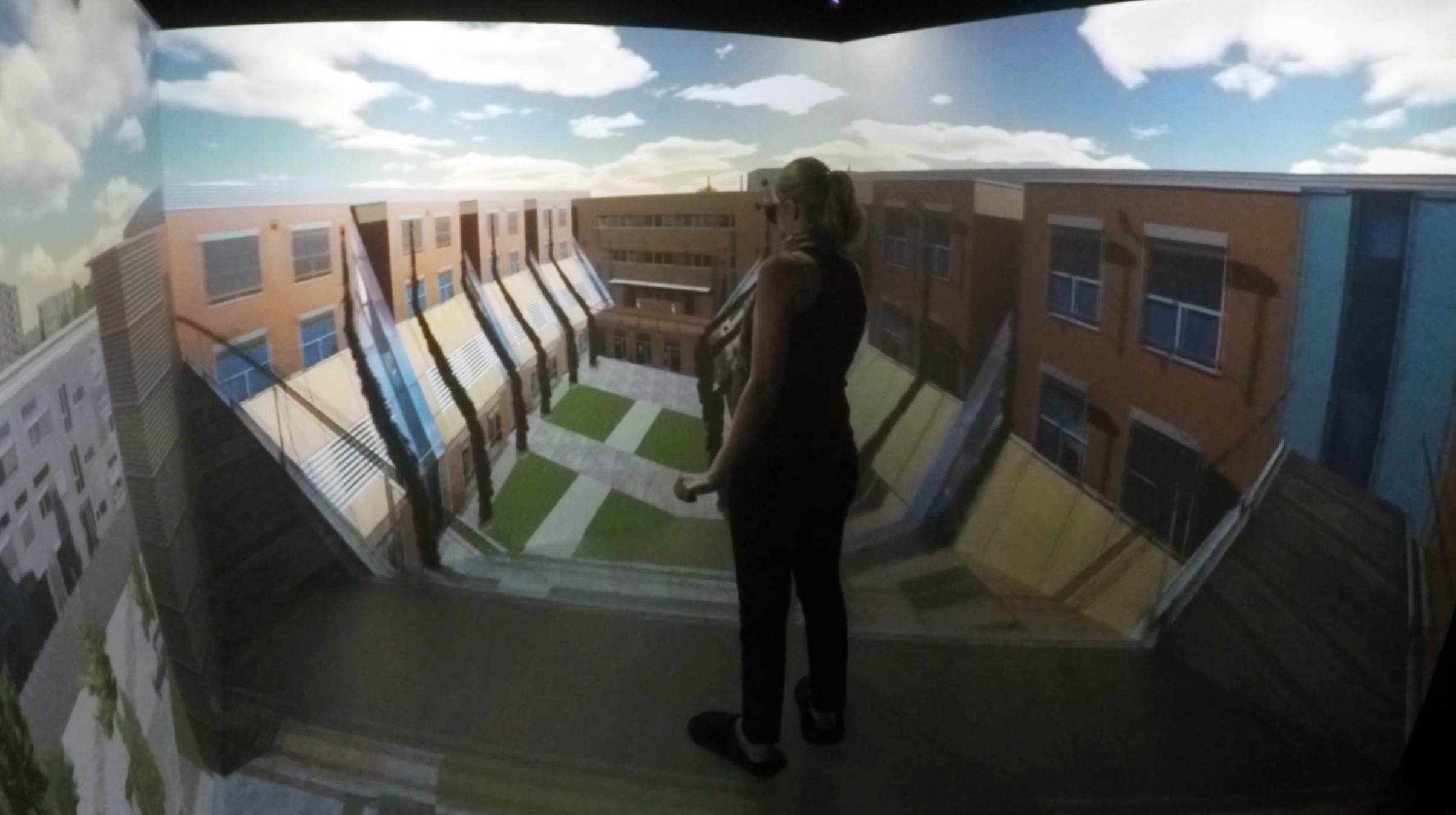
The VR and AR applications developed in VR-Planning were tested on the real application examples seestadt Aspern and Bahnhof Kapfenberg. The applications enabled a virtual tour through the future street spaces in the quarter "Am Seebogen" as well as through the new Kapfenberg train station including the immediate surroundings. It was possible to switch between different design variants, experience the space from the perspective of a child, view different sun positions and the vegetation according to different time periods.
The results of the research project as well as concrete application examples with VR and AR for a participative planning of public street spaces were compiled in a guideline.
Project lead: AIT Mobility Department
Project partner: ostertag ARCHITECTS ZT GmbH, PlanSinn GmbH, Wien 3420 Aspern Development AG, Bytefex